Numerous anchors dating back to the 1800s can be found in Cane Bay. This pair lays in roughly 80 feet of water in an area known as Three Anchor Chute.

Lettuce Coral Along The Wall
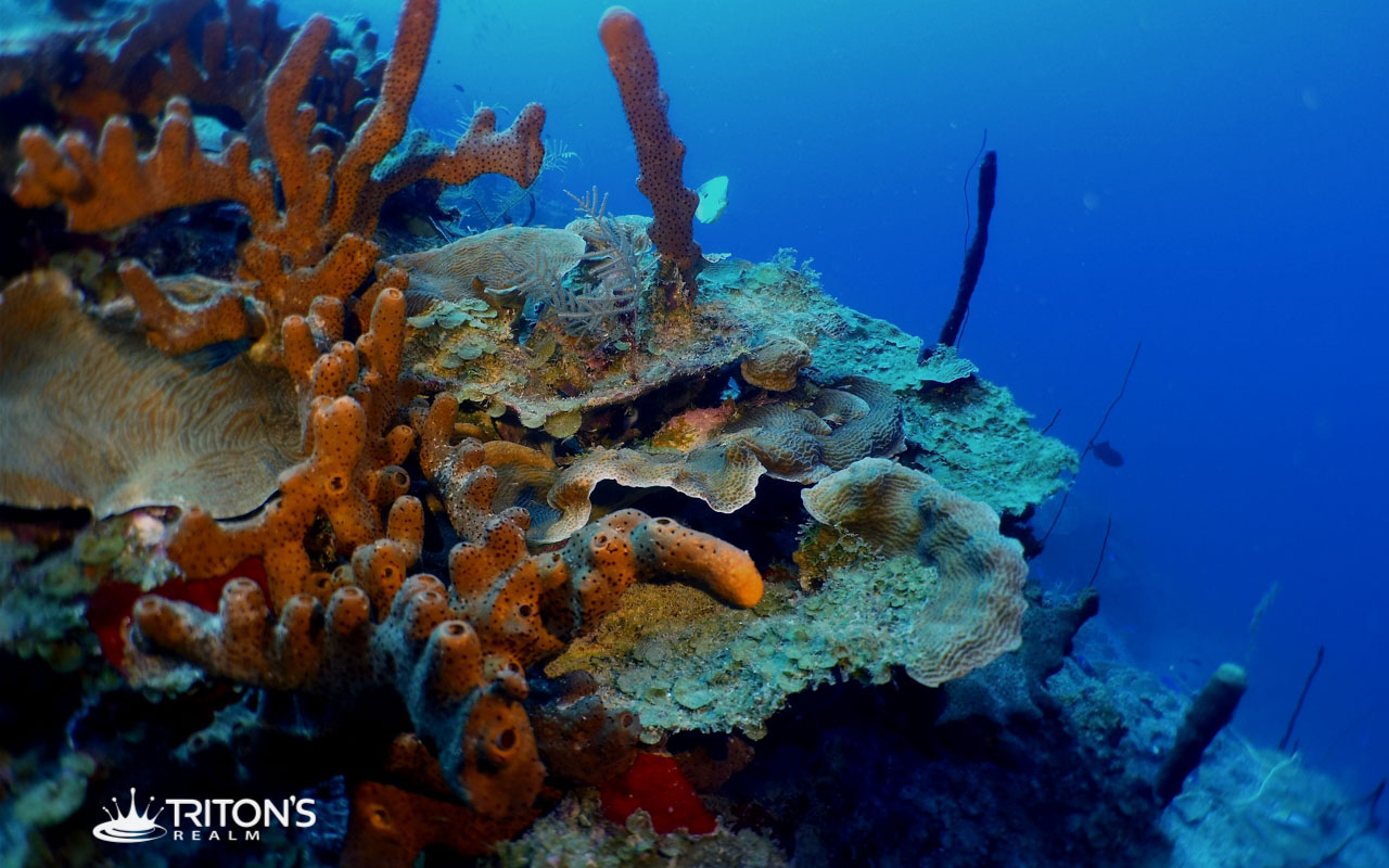
Thin plates of lettuce coral are a common site along the wall at Cane Bay.
The Wall
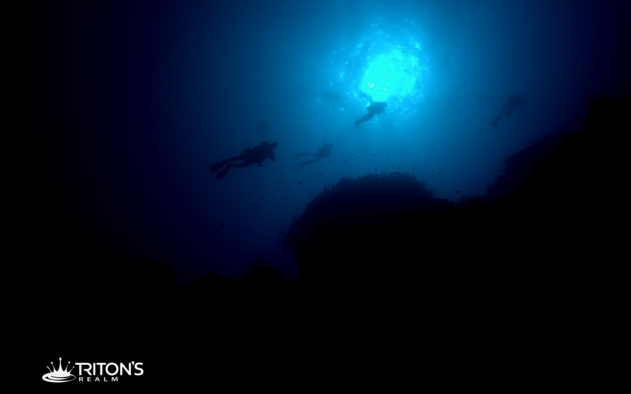
Looking up from 100 feet down, the wall along Cane Bay is awe inspiring.
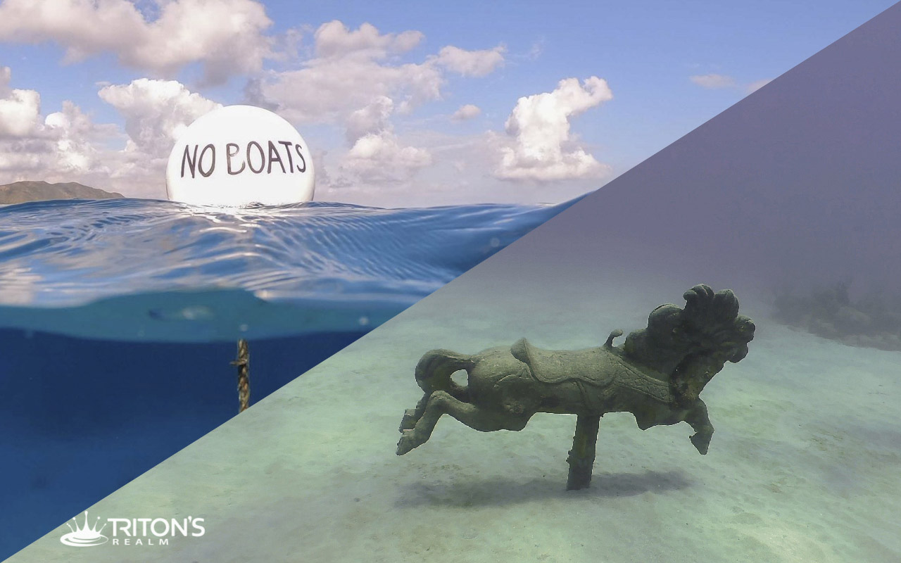
The training buoy is located in a large sandy area in 26 feet of water. Seabiscuit, a carousel horse, is a short swim to the east northeast from the buoy.
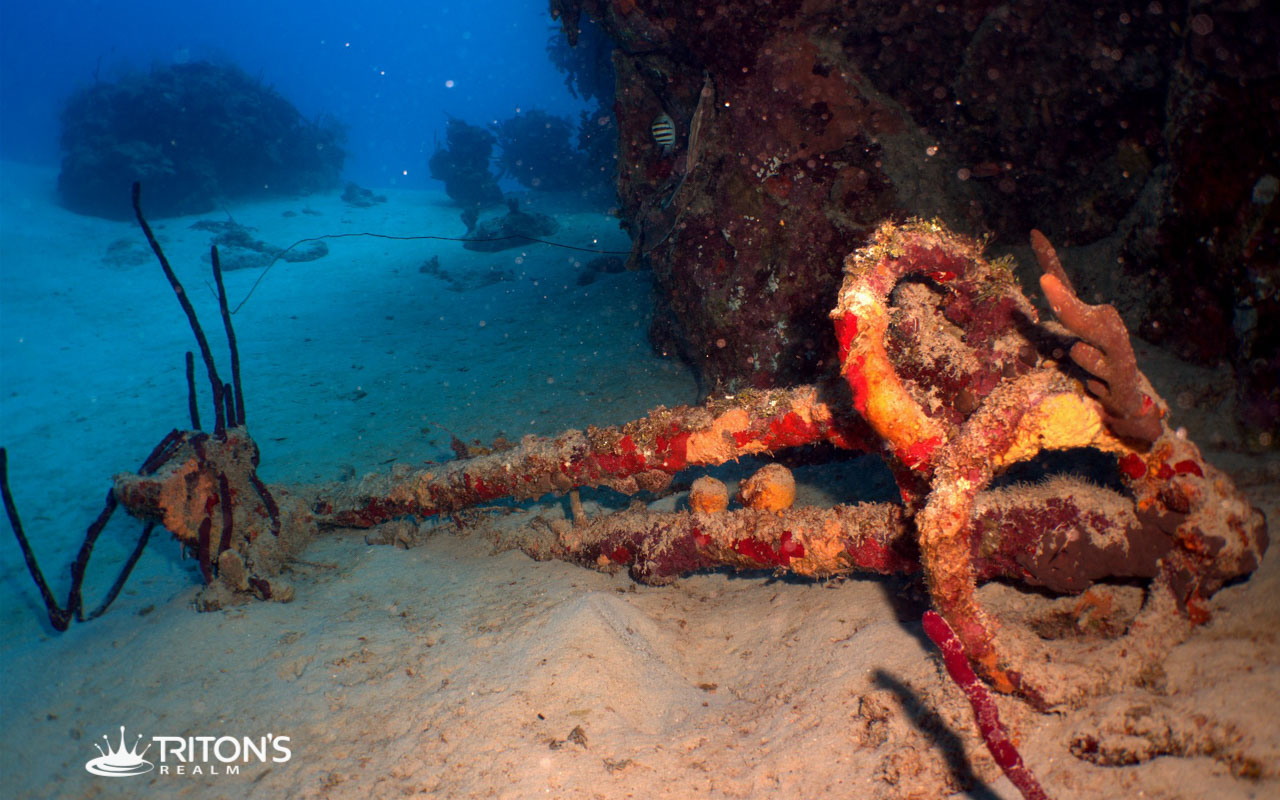
Coral Encrusted Anchor
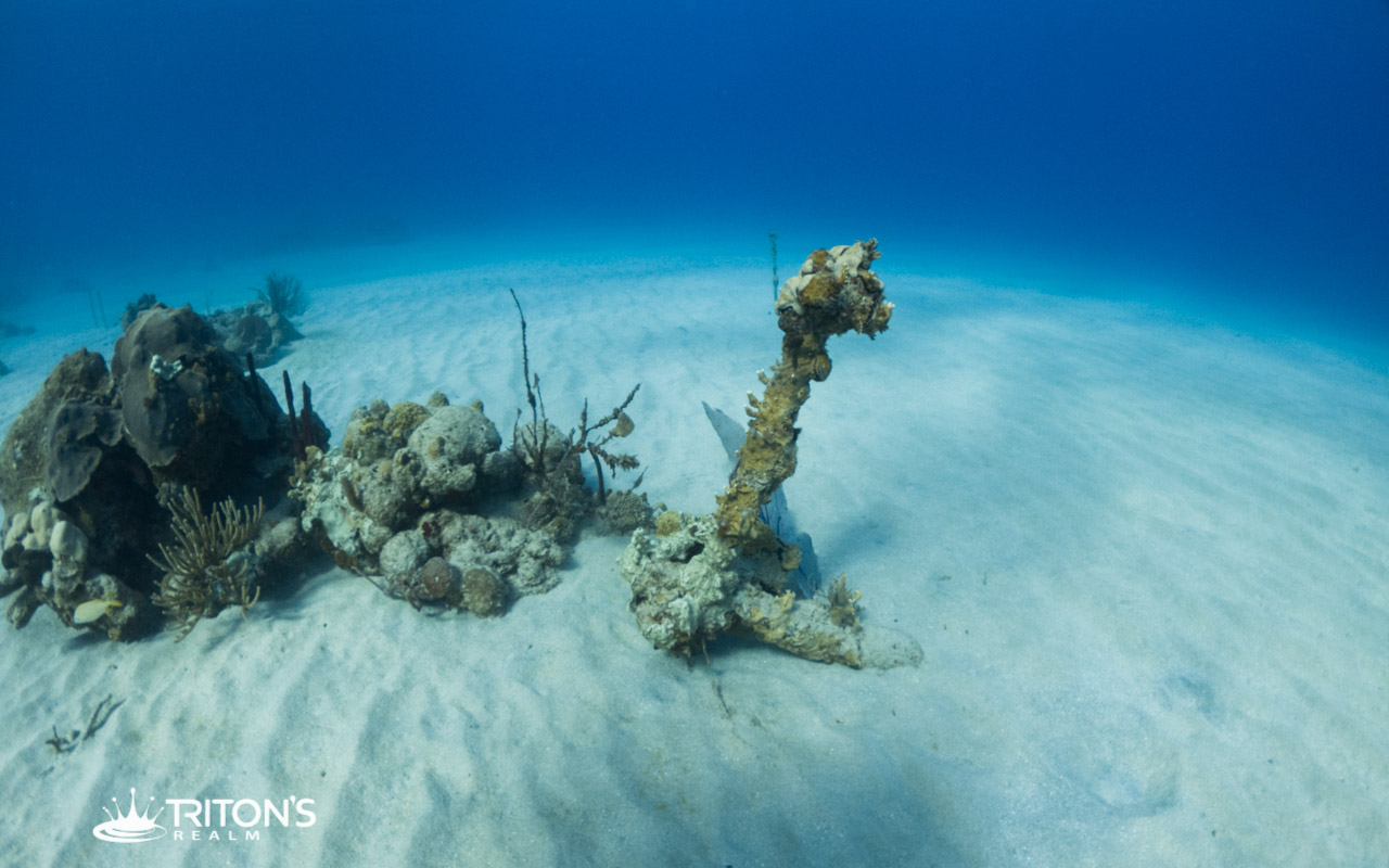
An ancient anchor sticks straight out of the sand near a small patch reef. The flukes of the anchor are entirely buried in the sand and the shank is encrusted with coral, but the shape is recognizable.
Coral Restoration
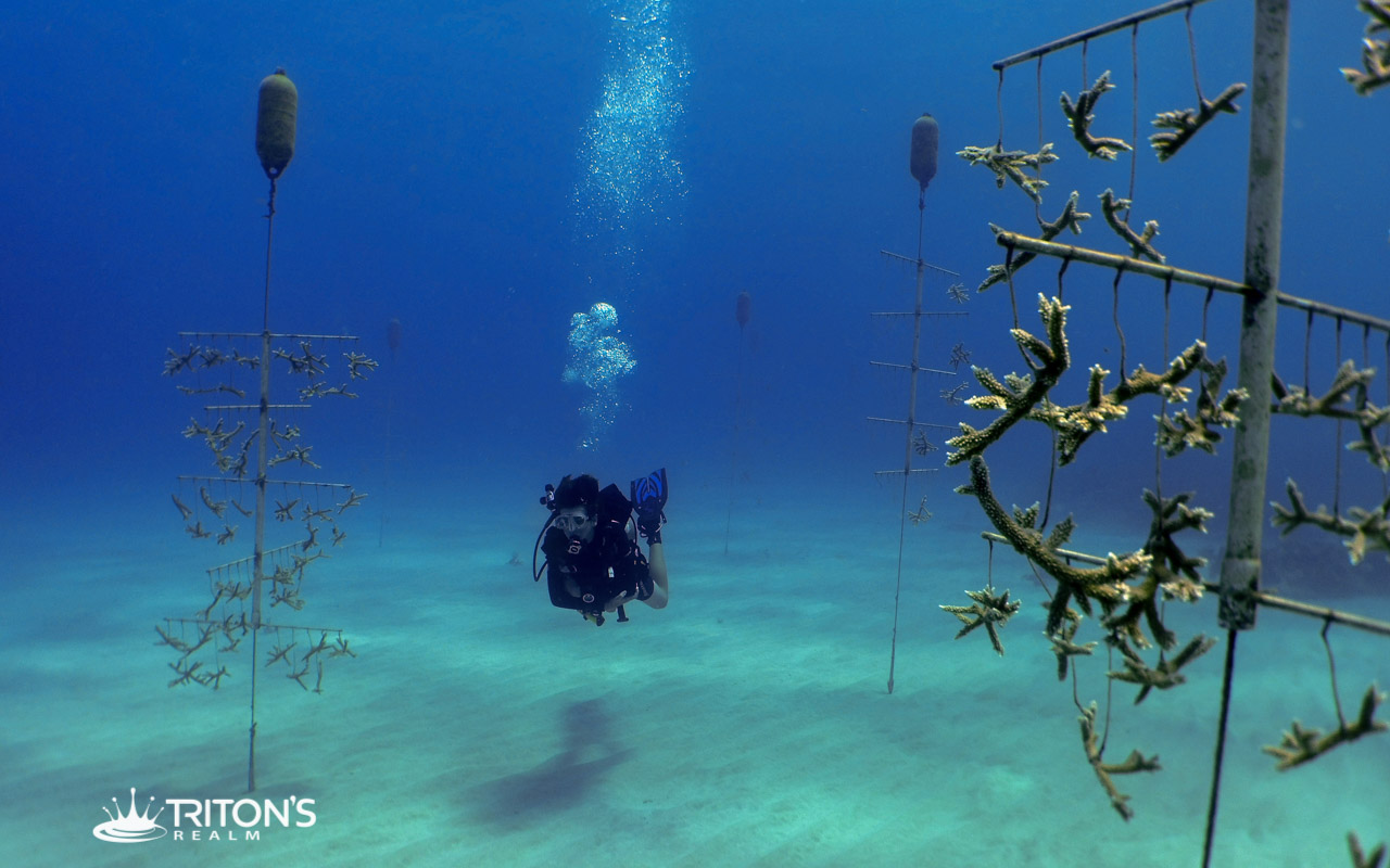
Coral restoration efforts at Cane Bay include fields of large “coral trees” that rise out of the sand, and aid in the growth of staghorn coral.
Old Chain

The huge links of an old chain blend in almost entirely with the rocky bottom after years of laying on the seafloor in 15 feet of water.